Weather Alert in Alaska
Winter Weather Advisory issued February 22 at 9:59AM AKST until February 25 at 3:00PM AKST by NWS Fairbanks AK
AREAS AFFECTED: Upper Tanana Valley; Delta Junction; Eastern Alaska Range North of Trims Camp
DESCRIPTION: * WHAT...Snow and blowing snow expected. Total snow accumulations between 4 and 7 inches. Winds gusting as high as 45 mph. Areas of blowing snow may reduce visibility to 1/2 mile or less at times. * WHERE...Delta Junction, Eastern Alaska Range North of Trims Camp, and Upper Tanana Valley. * WHEN...Until 3 PM AKST Wednesday. * IMPACTS...Travel could be very difficult. * ADDITIONAL DETAILS...Multiple days of light snow expected. Northwesterly winds increase late Monday into Tuesday increasing the chances of blowing snow hazards.
INSTRUCTION: Slow down and use caution while traveling. Visit 511.alaska.gov or call 5 1 1 for the latest road conditions.
Want more detail? Get the Complete 7 Day and Night Detailed Forecast!
Current U.S. National Radar--Current
The Current National Weather Radar is shown below with a UTC Time (subtract 5 hours from UTC to get Eastern Time).

National Weather Forecast--Current
The Current National Weather Forecast and National Weather Map are shown below.

National Weather Forecast for Tomorrow
Tomorrow National Weather Forecast and Tomorrow National Weather Map are show below.

North America Water Vapor (Moisture)
This map shows recent moisture content over North America. Bright and colored areas show high moisture (ie, clouds); brown indicates very little moisture present; black indicates no moisture.

Weather Topic: What are Cumulus Clouds?
Home - Education - Cloud Types - Cumulus Clouds
 Next Topic: Drizzle
Cumulus clouds are fluffy and textured with rounded tops, and
may have flat bottoms. The border of a cumulus cloud
is clearly defined, and can have the appearance of cotton or cauliflower.
Cumulus clouds form at low altitudes (rarely above 2 km) but can grow very tall,
becoming cumulus congestus and possibly the even taller cumulonimbus clouds.
When cumulus clouds become taller, they have a greater chance of producing precipitation.
Next Topic: Drizzle
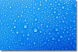
Weather Topic: What is Evaporation?
Home - Education - Precipitation - Evaporation
 Next Topic: Fog
Evaporation is the process which returns water from the earth
back to the atmosphere, and is another crucial process in the water cycle.
Evaporation is the transformation of liquid into gas, and it happens because
molecules are excited by the application of energy and turn into vapor.
In order for water to evaporate it has to be on the surface of a body of water.
Next Topic: Fog
Current conditions powered by WeatherAPI.com


