Weather Alert in Kansas
Severe Thunderstorm Warning issued September 3 at 7:20PM CDT until September 3 at 8:15PM CDT by NWS Wichita KS
AREAS AFFECTED: Sedgwick, KS
DESCRIPTION: SVRICT The National Weather Service in Wichita has issued a * Severe Thunderstorm Warning for... Eastern Sedgwick County in south central Kansas... * Until 815 PM CDT. * At 720 PM CDT, a severe thunderstorm was located near Valley Center, moving south at 40 mph. THIS IS A DESTRUCTIVE STORM FOR the Wichita Metro. HAZARD...Baseball size hail and 60 mph wind gusts. SOURCE...Radar indicated. IMPACT...People and animals outdoors will be severely injured. Expect shattered windows, extensive damage to roofs, siding, and vehicles. * Locations impacted include... Wichita, Derby, Haysville, Park City, Valley Center, Bel Aire, Mulvane, Maize, Clearwater, Sedgwick, Colwich, Downtown Wichita, Kechi, Eastborough, Bentley, West Wichita, East Wichita, Eisenhower National Airport, Mcconnell Air Force Base, and South Wichita. This includes the following highways... Interstate 135 between Mile Markers 0 and 22. Interstate 35 between Mile Markers 34 and 50.
INSTRUCTION: For your protection move to an interior room on the lowest floor of a building.
Want more detail? Get the Complete 7 Day and Night Detailed Forecast!
Current U.S. National Radar--Current
The Current National Weather Radar is shown below with a UTC Time (subtract 5 hours from UTC to get Eastern Time).

National Weather Forecast--Current
The Current National Weather Forecast and National Weather Map are shown below.

National Weather Forecast for Tomorrow
Tomorrow National Weather Forecast and Tomorrow National Weather Map are show below.

North America Water Vapor (Moisture)
This map shows recent moisture content over North America. Bright and colored areas show high moisture (ie, clouds); brown indicates very little moisture present; black indicates no moisture.

Weather Topic: What are Hole Punch Clouds?
Home - Education - Cloud Types - Hole Punch Clouds
 Next Topic: Mammatus Clouds
A hole punch cloud is an unusual occurrence when a disk-shaped
hole appears in a cirrostratus, cirrocumulus, or altocumulus cloud.
When part of the cloud forms ice crystals, water droplets in the surrounding area
of the cloud evaporate. The effect of this process produces a large elliptical
gap in the cloud. The hole punch cloud formation is rare, but it is not specific
to any geographic area.
Other names which have been used to describe this phenomena include fallstreak hole,
skypunch, and cloud hole.
Next Topic: Mammatus Clouds
Weather Topic: What are Nimbostratus Clouds?
Home - Education - Cloud Types - Nimbostratus Clouds
 Next Topic: Precipitation
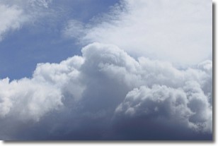
A nimbostratus cloud is similar to a stratus cloud in its formless,
smooth appearance. However, a nimbostratus cloud is darker than a stratus cloud,
because it is thicker.
Unlike a stratus cloud, a nimbostratus cloud typically brings with it the threat
of moderate to heavy precipitation. In some cases, the precipitation may evaporate
before reaching the ground, a phenomenon known as virga.
Next Topic: Precipitation
Current conditions powered by WeatherAPI.com


