Weather Alert in Alaska
Winter Weather Advisory issued February 28 at 10:51PM AKST until March 2 at 6:00AM AKST by NWS Juneau AK
AREAS AFFECTED: Prince of Wales Island; City and Borough of Wrangell
DESCRIPTION: ...CENTRAL AND SOUTHERN PANHANDLE SNOW SATURDAY WITH POTENTIAL FOR MORE SNOW SUNDAY... Steady snowfall continues across a majority of the panhandle and will continue as the low moves into the eastern gulf through Saturday night before beginning to diminish. South to southwest winds are causing temperatures to warm over the southern outer coast with precipitation becoming a mix or changing to all rain. Through Saturday night, snow will end on the NW side of the low, from Sitka to Juneau and northward. Moisture will decrease overnight Saturday across the south, but then redevelop on Sunday as another system moves in. The rain/snow line will likely hover in vicinity of Sumner Strait Sunday into Monday with additional heavy snow expected for the Petersburg and Wrangell areas and lighter snow northward. A separate low pressure system looks to affect the region on Tuesday with potential for snow to push northward once again. * WHAT...Snow expected. Total snow accumulations of up to 9 inches. * WHERE...Prince of Wales Island and City and Borough of Wrangell. * WHEN...From 6 AM Sunday to 6 AM AKST Monday. * IMPACTS...Travel could be very difficult and is discouraged. * ADDITIONAL DETAILS...Another surge of moisture will bring higher snowfall rates by late Sunday morning. A warm push is expected to lower snowfall ratios and cause a transition to mixed precipitation by Monday morning.
INSTRUCTION: Slow down and use caution while traveling. People are urged to prepare their property before the onset of winter weather. For the latest road conditions, where available, call 5 1 1 or visit 511.alaska.gov.
Want more detail? Get the Complete 7 Day and Night Detailed Forecast!
Current U.S. National Radar--Current
The Current National Weather Radar is shown below with a UTC Time (subtract 5 hours from UTC to get Eastern Time).

National Weather Forecast--Current
The Current National Weather Forecast and National Weather Map are shown below.

National Weather Forecast for Tomorrow
Tomorrow National Weather Forecast and Tomorrow National Weather Map are show below.

North America Water Vapor (Moisture)
This map shows recent moisture content over North America. Bright and colored areas show high moisture (ie, clouds); brown indicates very little moisture present; black indicates no moisture.

Weather Topic: What is Drizzle?
Home - Education - Precipitation - Drizzle
 Next Topic: Evaporation
Drizzle is precipitation in the form of water droplets which are
smaller than raindrops.
Drizzle is characterized by fine, gently falling droplets and typically does not
impact human habitation in a negative way. The exception to this is freezing drizzle,
a condition where drizzle freezes immediately upon reaching earth's surface.
Freezing drizzle is still less dangerous than freezing rain, but can
potentially result in hazardous road conditions.
Next Topic: Evaporation
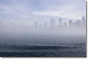
Weather Topic: What is Fog?
Home - Education - Cloud Types - Fog
 Next Topic: Fractus Clouds
Fog is technically a type of stratus cloud, which lies along the
ground and obscures visibility.
It is usually created when humidity in the air condenses into tiny water droplets.
Because of this, some places are more prone to foggy weather, such as regions
close to a body of water.
Fog is similar to mist; both are the appearance of water droplets suspended in
the air, but fog is the term applied to the condition when visibility is less than 1 km.
Next Topic: Fractus Clouds
Current conditions powered by WeatherAPI.com


