Weather Alert in Illinois
Flood Warning issued June 10 at 12:11PM EDT until June 11 at 10:00AM EDT by NWS Indianapolis IN
AREAS AFFECTED: Crawford, IL; Lawrence, IL; Knox, IN; Sullivan, IN
DESCRIPTION: ...The Flood Warning continues for the following rivers in Indiana... Illinois... Wabash River at Riverton. Wabash River at Hutsonville Legacy Power Plant Site. .Rainfall amounts within the past few days of two to four inches across western Indiana is producing minor flooding along the lower stretch of the Wabash River. Flooding is only expected to last for a couple of days with levels of a foot or two above flood stage. * WHAT...Minor flooding is occurring and minor flooding is forecast. * WHERE...Wabash River at Riverton. * WHEN...Until late tomorrow morning. * IMPACTS...At 16.0 feet, Some agricultural lands underwater. A few rural roads in Crawford County, Illinois close as water backs up Minnow Slough. High water affects campground at Leaverton Park in Palestine. A few private roads near the Gill Township levee in Sullivan County may flood. Water level is at the top of most makeshift levees. * ADDITIONAL DETAILS... - At 12:00 PM EDT Tuesday /11:00 AM CDT Tuesday/ the stage was 15.2 feet. - Recent Activity...The maximum river stage in the 24 hours ending at 12:00 PM EDT Tuesday /11:00 AM CDT Tuesday/ was 15.3 feet. - Forecast...The river is expected to fall below flood stage late this evening and continue falling and remain below flood stage. - Flood stage is 15.0 feet. - http://www.weather.gov/safety/flood
INSTRUCTION: Turn around, don't drown when encountering flooded roads. Most flood deaths occur in vehicles. Additional information is available at www.weather.gov/ind. The next statement should be issued late tonight by around 315 AM EDT /215 AM CDT/.
Want more detail? Get the Complete 7 Day and Night Detailed Forecast!
Current U.S. National Radar--Current
The Current National Weather Radar is shown below with a UTC Time (subtract 5 hours from UTC to get Eastern Time).

National Weather Forecast--Current
The Current National Weather Forecast and National Weather Map are shown below.

National Weather Forecast for Tomorrow
Tomorrow National Weather Forecast and Tomorrow National Weather Map are show below.

North America Water Vapor (Moisture)
This map shows recent moisture content over North America. Bright and colored areas show high moisture (ie, clouds); brown indicates very little moisture present; black indicates no moisture.

Weather Topic: What are Mammatus Clouds?
Home - Education - Cloud Types - Mammatus Clouds
 Next Topic: Nimbostratus Clouds
A mammatus cloud is a cloud with a unique feature which resembles
a web of pouches hanging along the base of the cloud.
In the United States, mammatus clouds tend to form in the warmer months, commonly
in the Midwest and eastern regions.
While they usually form at the bottom of a cumulonimbis cloud, they can also form
under altostratus, altocumulus, stratocumulus, and cirrus clouds. Mammatus clouds
warn that severe weather is close.
Next Topic: Nimbostratus Clouds
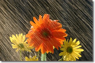
Weather Topic: What is Precipitation?
Home - Education - Precipitation - Precipitation
 Next Topic: Rain
Precipitation can refer to many different forms of water that
may fall from clouds. Precipitation occurs after a cloud has become saturated to
the point where its water particles are more dense than the air below the cloud.
In most cases, precipitation will reach the ground, but it is not uncommon for
precipitation to evaporate before it reaches the earth's surface.
When precipitation evaporates before it contacts the ground it is called Virga.
Graupel, hail, sleet, rain, drizzle, and snow are forms of precipitation, but fog
and mist are not considered precipitation because the water vapor which
constitutes them isn't dense enough to fall to the ground.
Next Topic: Rain
Current conditions powered by WeatherAPI.com


