Weather Alert in California
Coastal Flood Advisory issued February 23 at 12:10PM PST until February 24 at 5:00AM PST by NWS Eureka CA
AREAS AFFECTED: Northern Humboldt Coast
DESCRIPTION: * WHAT...High astronomical tides will cause minor flooding in low lying areas around Humboldt Bay. Up to half foot of saltwater inundation above ground level is possible near shorelines and tidal waterways. Between 8.7 and 8.9 feet MLLW at the North Spit tide gauge is predicted. * WHERE...Northern Humboldt Coast County. * WHEN...From 3 AM to 5 AM PST Tuesday. High tide is at 4:10 AM at the Humboldt Bay North Spit tide gauge. Saltwater inundation will be possible 1 to 2 hours before and after high tide. * IMPACTS...Flooding of low lying areas around Humboldt Bay including parks and roads with only isolated closures expected. Flooding will likely impact Jackson Ranch Road in the Arcata Bottoms and several roads in King Salmon.
INSTRUCTION: A Coastal Flood Advisory indicates that onshore winds and tides will combine to generate flooding of low areas along the shore. Feet Above Ground is locally defined as feet above the Highest Astronomical Tide or HAT.
Want more detail? Get the Complete 7 Day and Night Detailed Forecast!
Current U.S. National Radar--Current
The Current National Weather Radar is shown below with a UTC Time (subtract 5 hours from UTC to get Eastern Time).

National Weather Forecast--Current
The Current National Weather Forecast and National Weather Map are shown below.

National Weather Forecast for Tomorrow
Tomorrow National Weather Forecast and Tomorrow National Weather Map are show below.

North America Water Vapor (Moisture)
This map shows recent moisture content over North America. Bright and colored areas show high moisture (ie, clouds); brown indicates very little moisture present; black indicates no moisture.

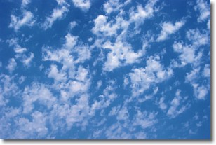
Weather Topic: What are Fractus Clouds?
Home - Education - Cloud Types - Fractus Clouds
 Next Topic: Freezing Rain
A fractus cloud (scud) is a fragmented, tattered cloud which has
likely been sheared off of another cloud. They are accessory clouds, meaning they
develop from parent clouds, and are named in a way which describes the original
cloud which contained them.
Fractus clouds which have originated from cumulus clouds are referred to as
cumulus fractus, while fractus clouds which have originated from stratus clouds
are referred to as stratus fractus. Under certain conditions a fractus cloud might
merge with another cloud, or develop into a cumulus cloud, but usually a
fractus cloud seen by itself will dissipate rapidly.
They are often observed on the leading and trailing edges of storm clouds,
and are a display of wind activity.
Next Topic: Freezing Rain
Weather Topic: What is Graupel?
Home - Education - Precipitation - Graupel
 Next Topic: Hail
Graupel is a form of precipitation that is created by atmospheric conditions
which cause supercooled water droplets to contact snow crystals and freeze to
their surface.
Sometimes known as soft hail or snow pellets, graupel is delicate and easily
destroyed by touch. Whereas hail usually falls during severe weather, graupel
doesn't require such conditions to form, and can form in mild precipitation
similar to situations which produce snowfall.
Next Topic: Hail
Current conditions powered by WeatherAPI.com


