Weather Alert in Louisiana
Special Weather Statement issued February 24 at 9:35AM CST by NWS New Orleans LA
AREAS AFFECTED: Pointe Coupee; West Feliciana; East Feliciana; St. Helena; Washington; Iberville; West Baton Rouge; East Baton Rouge; Assumption; St. James; St. John The Baptist; Upper Lafourche; St. Charles; Upper St. Bernard; Upper Terrebonne; Lower Terrebonne; Lower Lafourche; Coastal Jefferson; Lower Plaquemines; Lower St. Bernard; Northern Tangipahoa; Southeast St. Tammany; Western Orleans; Eastern Orleans; Northern St. Tammany; Southwestern St. Tammany; Central Tangipahoa; Lower Tangipahoa; Northern Livingston; Southern Livingston; Western Ascension; Eastern Ascension; Upper Jefferson; Lower Jefferson; Upper Plaquemines; Central Plaquemines; Wilkinson; Amite; Pike; Walthall; Pearl River
DESCRIPTION: * AFFECTED AREA: All of southeastern Louisiana as well as Wilkinson, Amite, Pike, Walthall and Pearl River Counties in southern Mississippi. * TIMING: From 9 now until 6 pm CST this evening. * 20 FOOT WIND: South 5 to 10 mph with gusts as high as 20 mph. * RELATIVE HUMIDITY: As low as 20 to 25 percent. * FUELS: Moderate to extreme drought continues across portions of the area. * IMPACTS: Weather conditions will be favorable for wildfire growth and spread.
INSTRUCTION: Outdoor activities that could inadvertently cause wildfires are discouraged. Avoid parking vehicles or using welding or grinding equipment near dry grass, brush, and weeds. Do not toss cigarette butts on the ground. Ensure tow chains do not drag on the ground. Be sure to report wildfires quickly to the nearest fire department or law enforcement office.
Want more detail? Get the Complete 7 Day and Night Detailed Forecast!
Current U.S. National Radar--Current
The Current National Weather Radar is shown below with a UTC Time (subtract 5 hours from UTC to get Eastern Time).

National Weather Forecast--Current
The Current National Weather Forecast and National Weather Map are shown below.

National Weather Forecast for Tomorrow
Tomorrow National Weather Forecast and Tomorrow National Weather Map are show below.

North America Water Vapor (Moisture)
This map shows recent moisture content over North America. Bright and colored areas show high moisture (ie, clouds); brown indicates very little moisture present; black indicates no moisture.

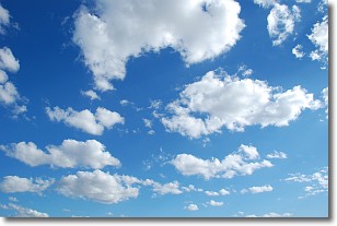
Weather Topic: What are Cumulonimbus Clouds?
Home - Education - Cloud Types - Cumulonimbus Clouds
 Next Topic: Cumulus Clouds
The final form taken by a growing cumulus cloud is the
cumulonimbus cloud, which is very tall and dense.
The tower of a cumulonimbus cloud can soar 23 km into the atmosphere, although
most commonly they stop growing at an altitude of 6 km.
Even small cumulonimbus clouds appear very large in comparison to other cloud types.
They can signal the approach of stormy weather, such as thunderstorms or blizzards.
Next Topic: Cumulus Clouds
Weather Topic: What is Drizzle?
Home - Education - Precipitation - Drizzle
 Next Topic: Evaporation
Drizzle is precipitation in the form of water droplets which are
smaller than raindrops.
Drizzle is characterized by fine, gently falling droplets and typically does not
impact human habitation in a negative way. The exception to this is freezing drizzle,
a condition where drizzle freezes immediately upon reaching earth's surface.
Freezing drizzle is still less dangerous than freezing rain, but can
potentially result in hazardous road conditions.
Next Topic: Evaporation
Current conditions powered by WeatherAPI.com


