Weather Alert in Texas
Flood Watch issued June 11 at 9:53PM CDT until June 12 at 7:00PM CDT by NWS Houston/Galveston TX
AREAS AFFECTED: Inland Harris; Wharton; Fort Bend; Inland Jackson; Inland Matagorda; Inland Brazoria; Inland Galveston; Coastal Harris; Coastal Jackson; Coastal Matagorda; Coastal Brazoria; Coastal Galveston; Matagorda Islands; Brazoria Islands; Galveston Island
DESCRIPTION: * WHAT...Flooding caused by excessive rainfall continues to be possible. * WHERE...Portions of south central and southeast Texas, including the following areas, in south central Texas, Coastal Jackson and Inland Jackson. In southeast Texas, Brazoria Islands, Coastal Brazoria, Coastal Galveston, Coastal Harris, Coastal Matagorda, Fort Bend, Galveston Island, Inland Brazoria, Inland Galveston, Inland Harris, Inland Matagorda, Matagorda Islands and Wharton. * WHEN...Through Thursday evening. * IMPACTS...Excessive runoff may result in flooding of rivers, creeks, streams, and other low-lying and flood-prone locations. Creeks and streams may rise out of their banks. Flooding may occur in poor drainage and urban areas. * ADDITIONAL DETAILS... - The next round of showers and thunderstorms is expected to pass through the region late tonight and Thursday morning. Though the band of storms should be moving at an average rate, upper level conditions are favorable for some training and regenerating storms. Several inches of rain in a short time period appear to be possible where this occurs. Model trends have shown the axis of heavier rainfall shifting south with each subsequent run with the latest suite showing deeper moisture advection and low level convergence setting up near the houston metro and southwestern counties. Watch area has been expanded by a generous amount to cover the evolving flood threat and uncertainty still present in short range forecast models. - http://www.weather.gov/safety/flood
INSTRUCTION: You should monitor later forecasts and be alert for possible Flood Warnings. Those living in areas prone to flooding should be prepared to take action should flooding develop.
Want more detail? Get the Complete 7 Day and Night Detailed Forecast!
Current U.S. National Radar--Current
The Current National Weather Radar is shown below with a UTC Time (subtract 5 hours from UTC to get Eastern Time).

National Weather Forecast--Current
The Current National Weather Forecast and National Weather Map are shown below.

National Weather Forecast for Tomorrow
Tomorrow National Weather Forecast and Tomorrow National Weather Map are show below.

North America Water Vapor (Moisture)
This map shows recent moisture content over North America. Bright and colored areas show high moisture (ie, clouds); brown indicates very little moisture present; black indicates no moisture.

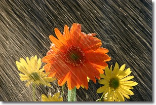
Weather Topic: What is Rain?
Home - Education - Precipitation - Rain
 Next Topic: Shelf Clouds
Precipitation in the form of water droplets is called rain.
Rain generally has a tendency to fall with less intensity over a greater period
of time, and when rainfall is more severe it is usually less sustained.
Rain is the most common form of precipitation and happens with greater frequency
depending on the season and regional influences. Cities have been shown to have
an observable effect on rainfall, due to an effect called the urban heat island.
Compared to upwind, monthly rainfall between twenty and forty miles downwind of
cities is 30% greater.
Next Topic: Shelf Clouds
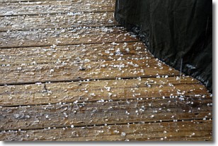
Weather Topic: What is Sleet?
Home - Education - Precipitation - Sleet
 Next Topic: Snow
Sleet is a form of precipitation in which small ice pellets are the primary
components. These ice pellets are smaller and more translucent than hailstones,
and harder than graupel. Sleet is caused by specific atmospheric conditions and
therefore typically doesn't last for extended periods of time.
The condition which leads to sleet formation requires a warmer body of air to be
wedged in between two sub-freezing bodies of air. When snow falls through a warmer
layer of air it melts, and as it falls through the next sub-freezing body of air
it freezes again, forming ice pellets known as sleet. In some cases, water
droplets don't have time to freeze before reaching the surface and the result is
freezing rain.
Next Topic: Snow
Current conditions powered by WeatherAPI.com


