Weather Alert in Ohio
Flood Warning issued April 1 at 10:10PM EDT until April 3 at 11:56AM EDT by NWS Cleveland OH
AREAS AFFECTED: Trumbull, OH
DESCRIPTION: ...The Flood Warning is extended for the following rivers in Ohio... Portage River At Woodville affecting Sandusky and Wood Counties. Huron River Near Milan affecting Erie County. Cuyahoga River At Old Portage affecting Summit County. Blanchard River Near Findlay affecting Hancock County. Maumee River At Waterville affecting Lucas and Wood Counties. Killbuck Creek Near Killbuck affecting Holmes and Wayne Counties. ...The Flood Warning continues for the following rivers in Ohio... Sandusky River At Tiffin affecting Seneca County. Black River At Elyria affecting Lorain County. Mahoning River At Youngstown affecting Mahoning and Trumbull Counties. Eagle Creek Above Findlay affecting Hancock County. Eagle Creek At Phalanx Station affecting Trumbull County. For the Portage River...including Woodville...Minor flooding is forecast. For the Sandusky River...including Upper Sandusky, Fremont, Tiffin, Bucyrus...Minor flooding is forecast. For the Huron River...including Milan...Minor flooding is forecast. For the Black River...including Elyria...Minor flooding is forecast. For the Cuyahoga River...including Hiram Rapids, Jaite, Old Portage, Independence...Minor flooding is forecast. For the Blanchard River...including Findlay...Minor flooding is forecast. For the Maumee River...including Grand Rapids, Waterville...Minor flooding is forecast. For the Killbuck Creek...including Killbuck...Minor flooding is forecast. For the Mahoning River...including Leavittsburg, Warren, Youngstown...Minor flooding is forecast. For the Eagle Creek (Hancock)...including Findlay...Minor flooding is forecast. For the Eagle Creek (Trumbull)...including Phalanx Station...Minor flooding is forecast. * WHAT...Minor flooding is occurring and minor flooding is forecast. * WHERE...Eagle Creek at Phalanx Station. * WHEN...Until late Friday morning. * IMPACTS...At 13.0 feet, Flooding begins on Braceville Robinson Road. Portions of Barcley Messerly Road south of Eagle Creek Road will be impassable. Some homes will be threatened. * ADDITIONAL DETAILS... - At 9:00 PM EDT Wednesday the stage was 12.3 feet. - Forecast...The river is expected to rise to a crest of 12.4 feet late this evening. It will then fall below flood stage early Friday morning. - Flood stage is 9.5 feet. - Please visit www.weather.gov/safety/flood for flood safety and preparedness information.
INSTRUCTION: Turn around, don't drown when encountering flooded roads. Most flood deaths occur in vehicles. Additional information is available at www.weather.gov/cle. The next statement will be issued Thursday morning at 600 AM EDT.
Want more detail? Get the Complete 7 Day and Night Detailed Forecast!
Current U.S. National Radar--Current
The Current National Weather Radar is shown below with a UTC Time (subtract 5 hours from UTC to get Eastern Time).

National Weather Forecast--Current
The Current National Weather Forecast and National Weather Map are shown below.

National Weather Forecast for Tomorrow
Tomorrow National Weather Forecast and Tomorrow National Weather Map are show below.

North America Water Vapor (Moisture)
This map shows recent moisture content over North America. Bright and colored areas show high moisture (ie, clouds); brown indicates very little moisture present; black indicates no moisture.

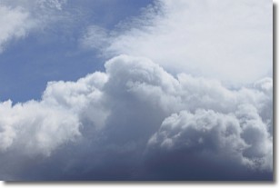
Weather Topic: What are Nimbostratus Clouds?
Home - Education - Cloud Types - Nimbostratus Clouds
 Next Topic: Precipitation
A nimbostratus cloud is similar to a stratus cloud in its formless,
smooth appearance. However, a nimbostratus cloud is darker than a stratus cloud,
because it is thicker.
Unlike a stratus cloud, a nimbostratus cloud typically brings with it the threat
of moderate to heavy precipitation. In some cases, the precipitation may evaporate
before reaching the ground, a phenomenon known as virga.
Next Topic: Precipitation
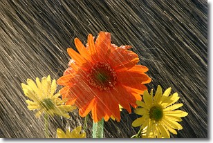
Weather Topic: What is Rain?
Home - Education - Precipitation - Rain
 Next Topic: Shelf Clouds
Precipitation in the form of water droplets is called rain.
Rain generally has a tendency to fall with less intensity over a greater period
of time, and when rainfall is more severe it is usually less sustained.
Rain is the most common form of precipitation and happens with greater frequency
depending on the season and regional influences. Cities have been shown to have
an observable effect on rainfall, due to an effect called the urban heat island.
Compared to upwind, monthly rainfall between twenty and forty miles downwind of
cities is 30% greater.
Next Topic: Shelf Clouds
Current conditions powered by WeatherAPI.com


