Weather Alert in Texas
Hydrologic Outlook issued August 24 at 1:34AM CDT by NWS Brownsville TX
AREAS AFFECTED: Brooks, TX
DESCRIPTION: ESFBRO The Brownsville Texas National Weather Service Office has implemented Advanced Hydrologic Prediction Service (AHPS) for the Los Olmos Creek basin in Deep South Texas. AHPS enables the National Weather Service to provide long-range probabilistic outlooks. This service is also available on the internet. In the table below...the 90 through 10 percent columns indicate the chance the creek could rise above the listed stage levels in the next 90 days. Example: The Los Olmos Creek near Falfurrias has a flood stage of 11 feet. There is a 50 percent chance the Falfurrias forecast point will rise above 2.2 feet during the next 90 days. Chance of Exceeding Stages at Specific Locations Valid [08/20/2025 - 11/18/2025] Location FS(FT) 90% 80% 70% 60% 50% 40% 30% 20% 10% -------- ----- --- --- --- --- --- --- --- --- --- Los Olmos Creek Falfurrias 11.0 1.8 1.8 1.8 2.0 2.2 3.0 3.7 4.5 4.9 This long-range probabilistic outlook contains numbers that are calculated using multiple scenarios from 50 years of historical climatological and stream flow data. These numbers also take into account current conditions of the creek and soil moisture. By providing the complete range of probabilistic numbers...the level of risk associated with the long-range planning decisions can be determined. Additional supportive data and explanation are available on the internet at: http://water.weather.gov/ahps2/long_range.php?wfo=bro Long range probabilistic outlooks are issued around the third Thursday of every month.
INSTRUCTION: N/A
Want more detail? Get the Complete 7 Day and Night Detailed Forecast!
Current U.S. National Radar--Current
The Current National Weather Radar is shown below with a UTC Time (subtract 5 hours from UTC to get Eastern Time).

National Weather Forecast--Current
The Current National Weather Forecast and National Weather Map are shown below.

National Weather Forecast for Tomorrow
Tomorrow National Weather Forecast and Tomorrow National Weather Map are show below.

North America Water Vapor (Moisture)
This map shows recent moisture content over North America. Bright and colored areas show high moisture (ie, clouds); brown indicates very little moisture present; black indicates no moisture.

Weather Topic: What are Hole Punch Clouds?
Home - Education - Cloud Types - Hole Punch Clouds
 Next Topic: Mammatus Clouds
A hole punch cloud is an unusual occurrence when a disk-shaped
hole appears in a cirrostratus, cirrocumulus, or altocumulus cloud.
When part of the cloud forms ice crystals, water droplets in the surrounding area
of the cloud evaporate. The effect of this process produces a large elliptical
gap in the cloud. The hole punch cloud formation is rare, but it is not specific
to any geographic area.
Other names which have been used to describe this phenomena include fallstreak hole,
skypunch, and cloud hole.
Next Topic: Mammatus Clouds
Weather Topic: What are Nimbostratus Clouds?
Home - Education - Cloud Types - Nimbostratus Clouds
 Next Topic: Precipitation
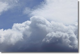
A nimbostratus cloud is similar to a stratus cloud in its formless,
smooth appearance. However, a nimbostratus cloud is darker than a stratus cloud,
because it is thicker.
Unlike a stratus cloud, a nimbostratus cloud typically brings with it the threat
of moderate to heavy precipitation. In some cases, the precipitation may evaporate
before reaching the ground, a phenomenon known as virga.
Next Topic: Precipitation
Current conditions powered by WeatherAPI.com


