Weather Alert in Kansas
Red Flag Warning issued March 21 at 9:58PM CDT until March 22 at 7:00PM CDT by NWS Topeka KS
AREAS AFFECTED: Republic; Washington; Marshall; Nemaha; Brown; Cloud; Clay; Riley; Pottawatomie; Jackson; Jefferson; Ottawa; Dickinson; Geary; Morris; Wabaunsee; Shawnee; Douglas; Lyon; Osage; Franklin; Coffey; Anderson
DESCRIPTION: ...RED FLAG WARNING IN EFFECT THROUGH THIS EVENING... ...RED FLAG WARNING IN EFFECT FROM SUNDAY MORNING THROUGH SUNDAY EVENING... ...RED FLAG WARNING WILL EXPIRE AT 10 PM CDT THIS EVENING FOR THE ENTIRE AREA... * AFFECTED AREA...Fire Weather Zone 008 Republic, Fire Weather Zone 009 Washington, Fire Weather Zone 010 Marshall, Fire Weather Zone 011 Nemaha, Fire Weather Zone 012 Brown, Fire Weather Zone 020 Cloud, Fire Weather Zone 021 Clay, Fire Weather Zone 022 Riley, Fire Weather Zone 023 Pottawatomie, Fire Weather Zone 024 Jackson, Fire Weather Zone 026 Jefferson, Fire Weather Zone 034 Ottawa, Fire Weather Zone 035 Dickinson, Fire Weather Zone 036 Geary, Fire Weather Zone 037 Morris, Fire Weather Zone 038 Wabaunsee, Fire Weather Zone 039 Shawnee, Fire Weather Zone 040 Douglas, Fire Weather Zone 054 Lyon, Fire Weather Zone 055 Osage, Fire Weather Zone 056 Franklin, Fire Weather Zone 058 Coffey and Fire Weather Zone 059 Anderson. * TIMING...From 9 AM to 7 PM CDT Sunday. * WINDS...Northwest 20 to 30 mph with gusts up to 45 mph. * RELATIVE HUMIDITY...As low as 25 percent. * TEMPERATURES...Up to 77. * IMPACTS...Any fire that develops will catch and spread quickly. Outdoor burning is not recommended.
INSTRUCTION: A Red Flag Warning means that critical fire weather conditions are either occurring now, or will shortly. A combination of strong winds, low relative humidity, and warm temperatures can contribute to extreme fire behavior.
Want more detail? Get the Complete 7 Day and Night Detailed Forecast!
Current U.S. National Radar--Current
The Current National Weather Radar is shown below with a UTC Time (subtract 5 hours from UTC to get Eastern Time).

National Weather Forecast--Current
The Current National Weather Forecast and National Weather Map are shown below.

National Weather Forecast for Tomorrow
Tomorrow National Weather Forecast and Tomorrow National Weather Map are show below.

North America Water Vapor (Moisture)
This map shows recent moisture content over North America. Bright and colored areas show high moisture (ie, clouds); brown indicates very little moisture present; black indicates no moisture.

Weather Topic: What are Mammatus Clouds?
Home - Education - Cloud Types - Mammatus Clouds
 Next Topic: Nimbostratus Clouds
A mammatus cloud is a cloud with a unique feature which resembles
a web of pouches hanging along the base of the cloud.
In the United States, mammatus clouds tend to form in the warmer months, commonly
in the Midwest and eastern regions.
While they usually form at the bottom of a cumulonimbis cloud, they can also form
under altostratus, altocumulus, stratocumulus, and cirrus clouds. Mammatus clouds
warn that severe weather is close.
Next Topic: Nimbostratus Clouds
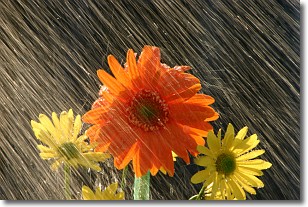
Weather Topic: What is Precipitation?
Home - Education - Precipitation - Precipitation
 Next Topic: Rain
Precipitation can refer to many different forms of water that
may fall from clouds. Precipitation occurs after a cloud has become saturated to
the point where its water particles are more dense than the air below the cloud.
In most cases, precipitation will reach the ground, but it is not uncommon for
precipitation to evaporate before it reaches the earth's surface.
When precipitation evaporates before it contacts the ground it is called Virga.
Graupel, hail, sleet, rain, drizzle, and snow are forms of precipitation, but fog
and mist are not considered precipitation because the water vapor which
constitutes them isn't dense enough to fall to the ground.
Next Topic: Rain
Current conditions powered by WeatherAPI.com


