Weather Alert in Washington
Flood Warning issued March 21 at 8:34PM PDT until March 23 at 3:12AM PDT by NWS Seattle WA
AREAS AFFECTED: Snohomish, WA
DESCRIPTION: ...The Flood Warning is extended for the following rivers in Washington... Snohomish River Near Monroe affecting Snohomish County. Snohomish River At Snohomish affecting Snohomish County. * WHAT...Moderate flooding is occurring, with the river gradually receding. * WHERE...Snohomish River at Snohomish. * WHEN...Until early Monday morning. * IMPACTS...At 28.0 feet, the Snohomish River will flood several roads...including the Snohomish-Monroe highway and Riverview Road...and low areas of the lower Snohomish valley that are not protected by levees. A stage of 28 feet on the Snohomish River corresponds to a Phase 3 in the Snohomish County flood program. * ADDITIONAL DETAILS... - At 8:00 PM PDT Saturday the stage was 28.8 feet. - Flood stage is 25.0 feet. - Recent Activity...The maximum river stage in the 24 hours ending at 8:00 PM PDT Saturday was 30.8 feet. - Forecast...The river will remain above moderate flood stage tonight and gradually recede through the next couple of days. It is expected to fall below flood stage late Sunday night, and continue to below 20.0 ft Monday morning. - http://www.weather.gov/safety/flood
INSTRUCTION: Caution is urged when walking near riverbanks. Be especially cautious at night when it is harder to recognize the dangers of flooding. Turn around, don't drown when encountering flooded roads. Most flood deaths occur in vehicles. Motorists should not attempt to drive around barricades or drive cars through flooded areas. Additional information is available at www.weather.gov. The next statement will be issued by late tonight at 445 AM PDT.
Want more detail? Get the Complete 7 Day and Night Detailed Forecast!
Current U.S. National Radar--Current
The Current National Weather Radar is shown below with a UTC Time (subtract 5 hours from UTC to get Eastern Time).

National Weather Forecast--Current
The Current National Weather Forecast and National Weather Map are shown below.

National Weather Forecast for Tomorrow
Tomorrow National Weather Forecast and Tomorrow National Weather Map are show below.

North America Water Vapor (Moisture)
This map shows recent moisture content over North America. Bright and colored areas show high moisture (ie, clouds); brown indicates very little moisture present; black indicates no moisture.

Weather Topic: What are Cumulus Clouds?
Home - Education - Cloud Types - Cumulus Clouds
 Next Topic: Drizzle
Cumulus clouds are fluffy and textured with rounded tops, and
may have flat bottoms. The border of a cumulus cloud
is clearly defined, and can have the appearance of cotton or cauliflower.
Cumulus clouds form at low altitudes (rarely above 2 km) but can grow very tall,
becoming cumulus congestus and possibly the even taller cumulonimbus clouds.
When cumulus clouds become taller, they have a greater chance of producing precipitation.
Next Topic: Drizzle
Weather Topic: What is Evaporation?
Home - Education - Precipitation - Evaporation
 Next Topic: Fog
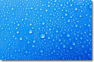
Evaporation is the process which returns water from the earth
back to the atmosphere, and is another crucial process in the water cycle.
Evaporation is the transformation of liquid into gas, and it happens because
molecules are excited by the application of energy and turn into vapor.
In order for water to evaporate it has to be on the surface of a body of water.
Next Topic: Fog
Current conditions powered by WeatherAPI.com


