Weather Alert in Kansas
Red Flag Warning issued March 22 at 12:43AM CDT until March 22 at 4:00AM CDT by NWS Hastings NE
AREAS AFFECTED: Phillips; Smith; Jewell; Rooks; Osborne; Mitchell; Valley; Greeley; Nance; Sherman; Howard; Merrick; Polk; Dawson; Buffalo; Hall; Hamilton; York; Gosper; Phelps; Kearney; Adams; Clay; Fillmore; Furnas; Harlan; Franklin; Webster; Nuckolls; Thayer
DESCRIPTION: ...CRITICAL FIRE WEATHER CONDITIONS CONTINUE TONIGHT... * WINDS...Tonight, winds out of the southwest between 10 to 20 mph and gusting up to 35 mph, will soon switch to a northerly direction between mainly 2AM and 6AM. Winds thereafter will increase to between 20 to 30 mph with gusts as high as 40 to 45 mph possible through the rest of the morning. * RELATIVE HUMIDITY...As low as 15 to 20 percent and gradually increasing through the early morning hours. * IMPACTS...Any fire that develops will spread quickly. Outdoor burning is not recommended. * ADDITIONAL DETAILS...The main concern is that any potential ongoing fires will be subject to a sharp/abrupt shift to strong north winds behind a surging cold front. Please note that these north winds may not reach areas near and south of the state line until after this Warning expires.
INSTRUCTION: A Red Flag Warning means that critical fire weather conditions are either occurring now, or will shortly. A combination of strong winds, low relative humidity, and warm temperatures can contribute to extreme fire behavior.
Want more detail? Get the Complete 7 Day and Night Detailed Forecast!
Current U.S. National Radar--Current
The Current National Weather Radar is shown below with a UTC Time (subtract 5 hours from UTC to get Eastern Time).

National Weather Forecast--Current
The Current National Weather Forecast and National Weather Map are shown below.

National Weather Forecast for Tomorrow
Tomorrow National Weather Forecast and Tomorrow National Weather Map are show below.

North America Water Vapor (Moisture)
This map shows recent moisture content over North America. Bright and colored areas show high moisture (ie, clouds); brown indicates very little moisture present; black indicates no moisture.

Weather Topic: What are Cumulus Clouds?
Home - Education - Cloud Types - Cumulus Clouds
 Next Topic: Drizzle
Cumulus clouds are fluffy and textured with rounded tops, and
may have flat bottoms. The border of a cumulus cloud
is clearly defined, and can have the appearance of cotton or cauliflower.
Cumulus clouds form at low altitudes (rarely above 2 km) but can grow very tall,
becoming cumulus congestus and possibly the even taller cumulonimbus clouds.
When cumulus clouds become taller, they have a greater chance of producing precipitation.
Next Topic: Drizzle
Weather Topic: What is Evaporation?
Home - Education - Precipitation - Evaporation
 Next Topic: Fog
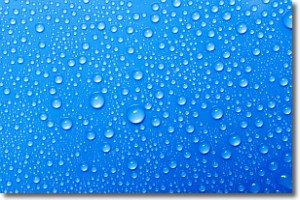
Evaporation is the process which returns water from the earth
back to the atmosphere, and is another crucial process in the water cycle.
Evaporation is the transformation of liquid into gas, and it happens because
molecules are excited by the application of energy and turn into vapor.
In order for water to evaporate it has to be on the surface of a body of water.
Next Topic: Fog
Current conditions powered by WeatherAPI.com


