Weather Alert in Michigan
Air Quality Alert issued August 3 at 10:58AM EDT by NWS Marquette MI
AREAS AFFECTED: Keweenaw; Ontonagon; Houghton; Baraga; Marquette; Alger; Luce; Gogebic; Iron; Dickinson; Menominee; Delta; Southern Schoolcraft; Southern Houghton; Northern Schoolcraft
DESCRIPTION: The Michigan Department of Environmental Quality has extended the ongoing Air Quality Advisory through Monday August 4, for elevated levels of fine particulates (PM2.5). Pollutants are expected to be in the Unhealthy for Sensitive Groups (USG, Orange AQI) range with some areas reaching Unhealthy (Red AQI) range. The alert is in effect for all Michigan counties. Wildfire smoke looks to persist throughout Michigan through at least Monday as winds shift, although it stays rather light. Overall hourly concentrations look to diminish but still stay in the USG range, therefore above our Advisory criteria. It is recommended that, when possible, you avoid strenuous outdoor activities, especially those with heart disease and respiratory diseases such as asthma. Monitor for symptoms such as wheezing, coughing, chest tightness, dizziness, or burning in nose, throat, and eyes. Reduce or eliminate activities that contribute to air pollution, such as outdoor burning, and use of residential wood burning devices. Keep windows closed overnight to prevent smoke from getting indoors and, if possible, run central air conditioning with MERV-13 or higher rated filters. For further information, please see EPA's Air Now site for up-to- date air quality data at https://www.airnow.gov For further health information, please see MDHHS' Wildfire Smoke and Your Health site at https://www.michigan.gov/mdhhs/safety-injury- prev/environmental-health/your-health-and-wildfire-smoke.
INSTRUCTION: N/A
Want more detail? Get the Complete 7 Day and Night Detailed Forecast!
Current U.S. National Radar--Current
The Current National Weather Radar is shown below with a UTC Time (subtract 5 hours from UTC to get Eastern Time).

National Weather Forecast--Current
The Current National Weather Forecast and National Weather Map are shown below.

National Weather Forecast for Tomorrow
Tomorrow National Weather Forecast and Tomorrow National Weather Map are show below.

North America Water Vapor (Moisture)
This map shows recent moisture content over North America. Bright and colored areas show high moisture (ie, clouds); brown indicates very little moisture present; black indicates no moisture.

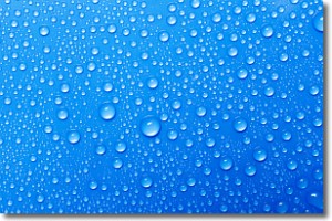
Weather Topic: What is Condensation?
Home - Education - Precipitation - Condensation
 Next Topic: Contrails
Condensation is the process which creates clouds, and therefore
it is a crucial process in the water cycle.
Condensation is the change of matter from a state of gas into a state of liquid,
and it happens because water molecules release heat into the atmosphere and
become organized into a more closely packed structure, what we might see as
water droplets.
Water is always present in the air around us as a vapor, but it's too small for
us to see. When water undergoes the process of condensation it becomes organized
into visible water droplets. You've probably seen condensation happen before on the
surface of a cold drink!
Next Topic: Contrails
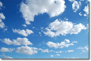
Weather Topic: What are Cumulonimbus Clouds?
Home - Education - Cloud Types - Cumulonimbus Clouds
 Next Topic: Cumulus Clouds
The final form taken by a growing cumulus cloud is the
cumulonimbus cloud, which is very tall and dense.
The tower of a cumulonimbus cloud can soar 23 km into the atmosphere, although
most commonly they stop growing at an altitude of 6 km.
Even small cumulonimbus clouds appear very large in comparison to other cloud types.
They can signal the approach of stormy weather, such as thunderstorms or blizzards.
Next Topic: Cumulus Clouds
Current conditions powered by WeatherAPI.com


