Weather Alert in New Mexico
Fire Weather Watch issued February 22 at 12:00PM MST until February 24 at 6:00PM MST by NWS Albuquerque NM
AREAS AFFECTED: Northeast Plains; Northeast Highlands; Central Highlands; East Central Plains
DESCRIPTION: ...FIRE WEATHER WATCH IN EFFECT FROM 10 AM TO 6 PM TUESDAY FOR THE NORTHEAST AND EAST CENTRAL HIGHLANDS AND PLAINS DUE TO GUSTY WEST WINDS AND LOW HUMIDITY... .Stronger mid and upper level westerly flow will result in gusty west winds along and east of the central mountain chain on Tuesday. The strongest west winds will be along the I-40 corridor from Clines Corners to the Texas border with peak gusts of 40 to 50 mph. These gusty west winds combined with well above normal temperatures and minimum relative humidity values between 7 and 14 percent will result in several hours of critical fire weather conditions across the northeast and east central highlands and plains during the midday and afternoon hours, especially across the I-40 corridor in eastern New Mexico and the I-25 corridor from Las Vegas to Springer. The National Weather Service in Albuquerque has issued a Fire Weather Watch...which is in effect from Tuesday morning through Tuesday afternoon. * AREA AND TIMING...Northeast Plains (Zone 104), Northeast Highlands (Zone 123), Central Highlands (Zone 125), and East Central Plains (Zone 126) Tuesday from 10 AM to 6 PM MST. * 20 FOOT WINDS...West winds 20 to 35 mph with peak gusts of 35 to 50 mph. * RELATIVE HUMIDITY...Minimum relative humidity values between 7 and 14 percent. * IMPACTS...Any fires that develop will likely spread rapidly. Outdoor burning is not recommended.
INSTRUCTION: Please advise the appropriate officials or fire crews in the field of this Fire Weather Watch.
Want more detail? Get the Complete 7 Day and Night Detailed Forecast!
Current U.S. National Radar--Current
The Current National Weather Radar is shown below with a UTC Time (subtract 5 hours from UTC to get Eastern Time).

National Weather Forecast--Current
The Current National Weather Forecast and National Weather Map are shown below.

National Weather Forecast for Tomorrow
Tomorrow National Weather Forecast and Tomorrow National Weather Map are show below.

North America Water Vapor (Moisture)
This map shows recent moisture content over North America. Bright and colored areas show high moisture (ie, clouds); brown indicates very little moisture present; black indicates no moisture.

Weather Topic: What are Hole Punch Clouds?
Home - Education - Cloud Types - Hole Punch Clouds
 Next Topic: Mammatus Clouds
A hole punch cloud is an unusual occurrence when a disk-shaped
hole appears in a cirrostratus, cirrocumulus, or altocumulus cloud.
When part of the cloud forms ice crystals, water droplets in the surrounding area
of the cloud evaporate. The effect of this process produces a large elliptical
gap in the cloud. The hole punch cloud formation is rare, but it is not specific
to any geographic area.
Other names which have been used to describe this phenomena include fallstreak hole,
skypunch, and cloud hole.
Next Topic: Mammatus Clouds
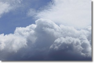
Weather Topic: What are Nimbostratus Clouds?
Home - Education - Cloud Types - Nimbostratus Clouds
 Next Topic: Precipitation
A nimbostratus cloud is similar to a stratus cloud in its formless,
smooth appearance. However, a nimbostratus cloud is darker than a stratus cloud,
because it is thicker.
Unlike a stratus cloud, a nimbostratus cloud typically brings with it the threat
of moderate to heavy precipitation. In some cases, the precipitation may evaporate
before reaching the ground, a phenomenon known as virga.
Next Topic: Precipitation
Current conditions powered by WeatherAPI.com


