Weather Alert in Arizona
Dust Storm Warning issued August 25 at 5:29PM MST until August 25 at 6:30PM MST by NWS Phoenix AZ
AREAS AFFECTED: Maricopa, AZ
DESCRIPTION: The National Weather Service in Phoenix has issued a * Dust Storm Warning for... Maricopa County in south central Arizona... * Until 630 PM MST. * At 529 PM MST, a wall of dust was along a line extending from near Saguaro Lake to near Granite Reef Dam to Papago Park, moving northwest at 30 mph. HAZARD...Near zero visibility with strong wind in excess of 50 mph. SOURCE...Doppler radar. IMPACT...Dangerous life-threatening travel. * This includes the following highways... AZ Interstate 17 between mile markers 218 and 228. AZ Route 51 between mile markers 11 and 15. AZ Route 87 between mile markers 187 and 204. Locations impacted include... Phoenix, Scottsdale, Fountain Hills, Paradise Valley, New River, Sugarloaf Mountain, Cave Creek, Carefree, Deer Valley Airport, McDowell Mountain Park, Saguaro Lake, Goldfield Ranch, Desert Mountain, Scottsdale Airport, and Desert Ridge Marketplace.
INSTRUCTION: Dust storms lead to dangerous driving conditions with visibility reduced to near zero. If driving, avoid dust storms if possible. If caught in one, pull off the road, turn off your lights and keep your foot off the brake.
Want more detail? Get the Complete 7 Day and Night Detailed Forecast!
Current U.S. National Radar--Current
The Current National Weather Radar is shown below with a UTC Time (subtract 5 hours from UTC to get Eastern Time).

National Weather Forecast--Current
The Current National Weather Forecast and National Weather Map are shown below.

National Weather Forecast for Tomorrow
Tomorrow National Weather Forecast and Tomorrow National Weather Map are show below.

North America Water Vapor (Moisture)
This map shows recent moisture content over North America. Bright and colored areas show high moisture (ie, clouds); brown indicates very little moisture present; black indicates no moisture.

Weather Topic: What are Wall Clouds?
Home - Education - Cloud Types - Wall Clouds
 Next Topic: Altocumulus Clouds
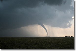
A wall cloud forms underneath the base of a cumulonimbus cloud,
and can be a hotbed for deadly tornadoes.
Wall clouds are formed by air flowing into the cumulonimbus clouds, which can
result in the wall cloud descending from the base of the cumulonimbus cloud, or
rising fractus clouds which join to the base of the storm cloud as the wall cloud
takes shape.
Wall clouds can be very large, and in the Northern Hemisphere they generally
form at the southern edge of cumulonimbus clouds.
Next Topic: Altocumulus Clouds
Weather Topic: What are Altostratus Clouds?
Home - Education - Cloud Types - Altostratus Clouds
 Next Topic: Cirrocumulus Clouds
Altostratus clouds form at mid to high-level altitudes
(between 2 and 7 km) and are created by a warm, stable air mass which causes
water vapor
to condense as it rise through the atmosphere. Usually altostratus clouds are
featureless sheets characterized by a uniform color.
In some cases, wind punching through the cloud formation may give it a waved
appearance, called altostratus undulatus. Altostratus clouds
are commonly seen with other cloud formations accompanying them.
Next Topic: Cirrocumulus Clouds
Current conditions powered by WeatherAPI.com


