Weather Alert in Connecticut
Special Weather Statement issued February 22 at 8:57PM EST by NWS Upton NY
AREAS AFFECTED: Northern Fairfield; Northern New Haven; Northern Middlesex; Northern New London; Southern Fairfield; Southern New Haven; Southern Middlesex; Southern New London; Western Passaic; Eastern Passaic; Hudson; Western Bergen; Eastern Bergen; Western Essex; Eastern Essex; Western Union; Eastern Union; Orange; Putnam; Rockland; Northern Westchester; Southern Westchester; New York (Manhattan); Bronx; Richmond (Staten Is.); Kings (Brooklyn); Northern Queens; Northern Nassau; Southern Queens; Southern Nassau
DESCRIPTION: ***Band of Heavy Snow Moving into the Area*** A heavy band of snow along the Connecticut coast into western Long Island will continue to lift to the northwest with possible snowfall rates of 2 to 3 inches an hour impacting the area. Periodic bands of heavy snow will move across the area through the night as low pressure rapidly intensifies to the south. In between bands, snowfall rates may drop off to about an inch per hour. In addition, winds will become a factor as the night progresses. Whiteout conditions are expected and will make travel treacherous and potentially life-threatening.
INSTRUCTION: N/A
Want more detail? Get the Complete 7 Day and Night Detailed Forecast!
Current U.S. National Radar--Current
The Current National Weather Radar is shown below with a UTC Time (subtract 5 hours from UTC to get Eastern Time).

National Weather Forecast--Current
The Current National Weather Forecast and National Weather Map are shown below.

National Weather Forecast for Tomorrow
Tomorrow National Weather Forecast and Tomorrow National Weather Map are show below.

North America Water Vapor (Moisture)
This map shows recent moisture content over North America. Bright and colored areas show high moisture (ie, clouds); brown indicates very little moisture present; black indicates no moisture.

Weather Topic: What are Cumulus Clouds?
Home - Education - Cloud Types - Cumulus Clouds
 Next Topic: Drizzle
Cumulus clouds are fluffy and textured with rounded tops, and
may have flat bottoms. The border of a cumulus cloud
is clearly defined, and can have the appearance of cotton or cauliflower.
Cumulus clouds form at low altitudes (rarely above 2 km) but can grow very tall,
becoming cumulus congestus and possibly the even taller cumulonimbus clouds.
When cumulus clouds become taller, they have a greater chance of producing precipitation.
Next Topic: Drizzle
Weather Topic: What is Evaporation?
Home - Education - Precipitation - Evaporation
 Next Topic: Fog
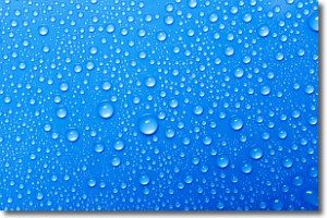
Evaporation is the process which returns water from the earth
back to the atmosphere, and is another crucial process in the water cycle.
Evaporation is the transformation of liquid into gas, and it happens because
molecules are excited by the application of energy and turn into vapor.
In order for water to evaporate it has to be on the surface of a body of water.
Next Topic: Fog
Current conditions powered by WeatherAPI.com


