Weather Alert in California
Dust Advisory issued August 25 at 3:10PM PDT until August 25 at 4:15PM PDT by NWS Phoenix AZ
AREAS AFFECTED: Imperial, CA
DESCRIPTION: The National Weather Service in Phoenix has issued a * Dust Advisory for... Southwestern Imperial County in southeastern California... * Until 415 PM PDT. * At 309 PM PDT, a wall of dust was along a line extending from near Calexico to near El Centro Naval Airfield to Plaster City. HAZARD...Less than one mile visibility with strong wind in excess of 50 mph. SOURCE...Doppler radar. IMPACT...Hazardous travel. * This includes the following highways... CA Interstate 8 near mile marker 1, and between mile markers 3 and 60. CA Route 111 between mile markers 1 and 19. CA Route 86 between mile markers 1 and 17. Locations impacted include... El Centro, Calexico, Imperial, Plaster City, Ocotillo, Holtville, Mt. Signal, El Centro Naval Airfield, Coyote Wells, Seeley, Bonds Corner, Heber, and Dixieland.
INSTRUCTION: Blowing dust brings reduced visibility, leading to dangerous driving conditions. If driving, avoid blowing dust if possible. If caught in dense blowing dust, pull off the road, turn off your lights and keep your foot off the brake. Motorists should not drive into an area of blowing dust. PULL ASIDE STAY ALIVE! Strong to severe thunderstorms are also possible behind this wall of dust. Keep updated with this quickly evolving situation.
Want more detail? Get the Complete 7 Day and Night Detailed Forecast!
Current U.S. National Radar--Current
The Current National Weather Radar is shown below with a UTC Time (subtract 5 hours from UTC to get Eastern Time).

National Weather Forecast--Current
The Current National Weather Forecast and National Weather Map are shown below.

National Weather Forecast for Tomorrow
Tomorrow National Weather Forecast and Tomorrow National Weather Map are show below.

North America Water Vapor (Moisture)
This map shows recent moisture content over North America. Bright and colored areas show high moisture (ie, clouds); brown indicates very little moisture present; black indicates no moisture.

Weather Topic: What are Cumulonimbus Clouds?
Home - Education - Cloud Types - Cumulonimbus Clouds
 Next Topic: Cumulus Clouds
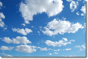
The final form taken by a growing cumulus cloud is the
cumulonimbus cloud, which is very tall and dense.
The tower of a cumulonimbus cloud can soar 23 km into the atmosphere, although
most commonly they stop growing at an altitude of 6 km.
Even small cumulonimbus clouds appear very large in comparison to other cloud types.
They can signal the approach of stormy weather, such as thunderstorms or blizzards.
Next Topic: Cumulus Clouds
Weather Topic: What is Drizzle?
Home - Education - Precipitation - Drizzle
 Next Topic: Evaporation
Drizzle is precipitation in the form of water droplets which are
smaller than raindrops.
Drizzle is characterized by fine, gently falling droplets and typically does not
impact human habitation in a negative way. The exception to this is freezing drizzle,
a condition where drizzle freezes immediately upon reaching earth's surface.
Freezing drizzle is still less dangerous than freezing rain, but can
potentially result in hazardous road conditions.
Next Topic: Evaporation
Current conditions powered by WeatherAPI.com


