Weather Alert in North Carolina
Winter Storm Warning issued February 22 at 5:21PM EST until February 24 at 12:00AM EST by NWS Blacksburg VA
AREAS AFFECTED: Ashe; Watauga; Smyth; Grayson
DESCRIPTION: Low pressure near Cape Hatteras, North Carolina, will strengthen into a major winter storm as it moves north along the East Coast. * WHAT...Heavy snow mainly for elevations above 3500 Feet. Total snow Total accumulations ranging from up to 3 inches in the lower elevations, to 5 to 12 inches above 3500 feet, especially in places like Beech Mountain, Mount Rogers and Flattop Mountain. Winds gusting as high as 50 mph. * WHERE...In North Carolina, Ashe and Watauga Counties. In Virginia, Grayson and Smyth Counties. * WHEN...Until midnight EST Monday Night. * IMPACTS...Roads, and especially bridges and overpasses, will likely become slick and hazardous. Visibilities may drop below 1/4 mile due to falling and blowing snow. Travel could be very difficult. The hazardous conditions could impact the Monday morning and evening commutes. Strong winds could cause tree damage. * ADDITIONAL DETAILS...Temperatures falling into the teens tonight, combined with the wind, will result in wind chills near zero late tonight and Monday.
INSTRUCTION: If you must travel, keep an extra flashlight, food, and water in your vehicle in case of an emergency. The latest road conditions for the state you are calling from can be obtained by calling 5 1 1. Persons should consider delaying all travel. Motorists should use extreme caution if travel is absolutely necessary.
Want more detail? Get the Complete 7 Day and Night Detailed Forecast!
Current U.S. National Radar--Current
The Current National Weather Radar is shown below with a UTC Time (subtract 5 hours from UTC to get Eastern Time).

National Weather Forecast--Current
The Current National Weather Forecast and National Weather Map are shown below.

National Weather Forecast for Tomorrow
Tomorrow National Weather Forecast and Tomorrow National Weather Map are show below.

North America Water Vapor (Moisture)
This map shows recent moisture content over North America. Bright and colored areas show high moisture (ie, clouds); brown indicates very little moisture present; black indicates no moisture.

Weather Topic: What are Cumulus Clouds?
Home - Education - Cloud Types - Cumulus Clouds
 Next Topic: Drizzle
Cumulus clouds are fluffy and textured with rounded tops, and
may have flat bottoms. The border of a cumulus cloud
is clearly defined, and can have the appearance of cotton or cauliflower.
Cumulus clouds form at low altitudes (rarely above 2 km) but can grow very tall,
becoming cumulus congestus and possibly the even taller cumulonimbus clouds.
When cumulus clouds become taller, they have a greater chance of producing precipitation.
Next Topic: Drizzle
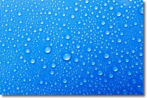
Weather Topic: What is Evaporation?
Home - Education - Precipitation - Evaporation
 Next Topic: Fog
Evaporation is the process which returns water from the earth
back to the atmosphere, and is another crucial process in the water cycle.
Evaporation is the transformation of liquid into gas, and it happens because
molecules are excited by the application of energy and turn into vapor.
In order for water to evaporate it has to be on the surface of a body of water.
Next Topic: Fog
Current conditions powered by WeatherAPI.com


