Weather Alert in Minnesota
Flood Warning issued August 24 at 9:29PM CDT until August 31 at 1:00PM CDT by NWS Twin Cities/Chanhassen MN
AREAS AFFECTED: Chippewa, MN; Renville, MN; Yellow Medicine, MN
DESCRIPTION: ...The Flood Warning continues for the following rivers in Minnesota... Minnesota River near Jordan affecting Sibley, Scott and Carver Counties. Minnesota River at Henderson MN19 affecting Sibley, Le Sueur and Scott Counties. Minnesota River at New Ulm affecting Brown, Blue Earth and Nicollet Counties. Minnesota River at Granite Falls HWY 212 affecting Chippewa, Renville and Yellow Medicine Counties. Minnesota River at Morton affecting Redwood and Renville Counties. Minnesota River at Montevideo affecting Chippewa, Lac qui Parle and Yellow Medicine Counties. ...The Flood Warning is cancelled for the following rivers in Minnesota... Redwood River near Redwood Falls affecting Redwood County. .Little to no rainfall is in the forecast over the next several days. Upstream rivers will continue to gradually fall as rivers downstream continue to rise. * WHAT...Minor flooding is occurring and minor flooding is forecast. * WHERE...Minnesota River at Granite Falls HWY 212. * WHEN...Until Sunday afternoon. * IMPACTS...At 885.0 feet, Flood waters begin to reach the alley way along the river at the foot bridge. * ADDITIONAL DETAILS... - At 815 PM CDT Sunday, the stage was 885.6 feet. - The river has started to gradually fall. - Forecast...The river is expected to rise to a crest of 885.6 feet just after midnight tonight. It will then fall below flood stage Saturday evening. - Flood stage is 885.0 feet.
INSTRUCTION: Turn around, don't drown when encountering flooded roads. Most flood deaths occur in vehicles. Caution is urged when walking near riverbanks.
Want more detail? Get the Complete 7 Day and Night Detailed Forecast!
Current U.S. National Radar--Current
The Current National Weather Radar is shown below with a UTC Time (subtract 5 hours from UTC to get Eastern Time).

National Weather Forecast--Current
The Current National Weather Forecast and National Weather Map are shown below.

National Weather Forecast for Tomorrow
Tomorrow National Weather Forecast and Tomorrow National Weather Map are show below.

North America Water Vapor (Moisture)
This map shows recent moisture content over North America. Bright and colored areas show high moisture (ie, clouds); brown indicates very little moisture present; black indicates no moisture.

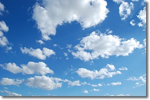
Weather Topic: What are Cumulonimbus Clouds?
Home - Education - Cloud Types - Cumulonimbus Clouds
 Next Topic: Cumulus Clouds
The final form taken by a growing cumulus cloud is the
cumulonimbus cloud, which is very tall and dense.
The tower of a cumulonimbus cloud can soar 23 km into the atmosphere, although
most commonly they stop growing at an altitude of 6 km.
Even small cumulonimbus clouds appear very large in comparison to other cloud types.
They can signal the approach of stormy weather, such as thunderstorms or blizzards.
Next Topic: Cumulus Clouds
Weather Topic: What is Drizzle?
Home - Education - Precipitation - Drizzle
 Next Topic: Evaporation
Drizzle is precipitation in the form of water droplets which are
smaller than raindrops.
Drizzle is characterized by fine, gently falling droplets and typically does not
impact human habitation in a negative way. The exception to this is freezing drizzle,
a condition where drizzle freezes immediately upon reaching earth's surface.
Freezing drizzle is still less dangerous than freezing rain, but can
potentially result in hazardous road conditions.
Next Topic: Evaporation
Current conditions powered by WeatherAPI.com


