Weather Alert in Nebraska
Dense Fog Advisory issued September 2 at 1:20AM CDT until September 2 at 10:00AM CDT by NWS Hastings NE
AREAS AFFECTED: Valley; Greeley; Nance; Sherman; Howard; Merrick; Polk; Dawson; York
DESCRIPTION: * WHAT...Visibility one-quarter mile or less in dense fog. * WHERE...Greeley, Howard, Merrick, Nance, Sherman, Valley, Polk, York, and Dawson Counties. * WHEN...Until 10 AM CDT this morning. * IMPACTS...Low visibility could make driving conditions hazardous, including for the Tuesday morning commute. * ADDITIONAL DETAILS...Although at least light fog is likely this morning across much of the Advisory area, the development of truly dense fog, reducing visibility to 1/4 mile or less, will likely be more hit-and-miss in nature...impacting some areas more than others. This will result in widely varying visibilities, including over short distances. Although not all areas will see truly dense fog, enough potential exists for dense fog within enough of the area to justify this Advisory.
INSTRUCTION: If driving, slow down, use your headlights, and leave plenty of distance ahead of you.
Want more detail? Get the Complete 7 Day and Night Detailed Forecast!
Current U.S. National Radar--Current
The Current National Weather Radar is shown below with a UTC Time (subtract 5 hours from UTC to get Eastern Time).

National Weather Forecast--Current
The Current National Weather Forecast and National Weather Map are shown below.

National Weather Forecast for Tomorrow
Tomorrow National Weather Forecast and Tomorrow National Weather Map are show below.

North America Water Vapor (Moisture)
This map shows recent moisture content over North America. Bright and colored areas show high moisture (ie, clouds); brown indicates very little moisture present; black indicates no moisture.

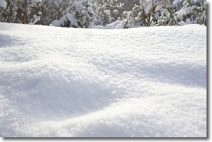
Weather Topic: What is Snow?
Home - Education - Precipitation - Snow
 Next Topic: Stratocumulus Clouds
Snow is precipitation taking the form of ice crystals. Each ice crystal, or snowflake,
has unique characteristics, but all of them grow in a hexagonal structure.
Snowfall can last for sustained periods of time and result in significant buildup
of snow on the ground.
On the earth's surface, snow starts out light and powdery, but as it begins to melt
it tends to become more granular, producing small bits of ice which have the consistency of
sand. After several cycles of melting and freezing, snow can become very dense
and ice-like, commonly known as snow pack.
Next Topic: Stratocumulus Clouds
Weather Topic: What are Stratus Clouds?
Home - Education - Cloud Types - Stratus Clouds
 Next Topic: Wall Clouds
Stratus clouds are similar to altostratus clouds, but form at a
lower altitude and are identified by their fog-like appearance, lacking the
distinguishing features of most clouds.
Stratus clouds are wider than most clouds, and their base has a smooth, uniform
look which is lighter in color than a nimbostratus cloud.
The presence of a stratus cloud indicates the possibility of minor precipitation,
such as drizzle, but heavier precipitation does not typically arrive in the form
of a stratus cloud.
Next Topic: Wall Clouds
Current conditions powered by WeatherAPI.com


