Weather Alert in Oregon
Winter Storm Watch issued March 30 at 10:38PM PDT until April 2 at 5:00PM PDT by NWS Portland OR
AREAS AFFECTED: North Oregon Cascades; Cascades of Marion and Linn Counties; Cascades of Lane County
DESCRIPTION: * WHAT...Heavy snow possible. Total snow accumulations between 10 to 18 inches possible. Winds could gust as high as 35 mph. * WHERE...Northern and Central Oregon Cascades. * WHEN...From late Tuesday night through Thursday afternoon. * IMPACTS...Roads, and especially bridges and overpasses, will likely become slick and hazardous. * ADDITIONAL DETAILS...Latest guidance suggests the heaviest snow accumulations are forecast over the Cascades from Marion to Lane Counties. There is a 50-75% chance snowfall rates will occasionally exceed 1 inch/hour along the Cascade passes between 4 PM Wednesday and 8 AM Thursday, resulting in hazardous travel conditions due to a combination of low visibilities and accumulating snow.
INSTRUCTION: Winterize your vehicle and have a winter emergency driving kit readily available. Make sure your emergency kit has the following items: flashlights, batteries, blankets, a shovel, water, non-perishable food items, tire chains, etc. Now is a good time to put snow tires on your vehicle. Check on friends and family to see if they need help preparing. Monitor the latest forecasts and warnings for updates on this situation.
Want more detail? Get the Complete 7 Day and Night Detailed Forecast!
Current U.S. National Radar--Current
The Current National Weather Radar is shown below with a UTC Time (subtract 5 hours from UTC to get Eastern Time).

National Weather Forecast--Current
The Current National Weather Forecast and National Weather Map are shown below.

National Weather Forecast for Tomorrow
Tomorrow National Weather Forecast and Tomorrow National Weather Map are show below.

North America Water Vapor (Moisture)
This map shows recent moisture content over North America. Bright and colored areas show high moisture (ie, clouds); brown indicates very little moisture present; black indicates no moisture.

Weather Topic: What are Mammatus Clouds?
Home - Education - Cloud Types - Mammatus Clouds
 Next Topic: Nimbostratus Clouds
A mammatus cloud is a cloud with a unique feature which resembles
a web of pouches hanging along the base of the cloud.
In the United States, mammatus clouds tend to form in the warmer months, commonly
in the Midwest and eastern regions.
While they usually form at the bottom of a cumulonimbis cloud, they can also form
under altostratus, altocumulus, stratocumulus, and cirrus clouds. Mammatus clouds
warn that severe weather is close.
Next Topic: Nimbostratus Clouds
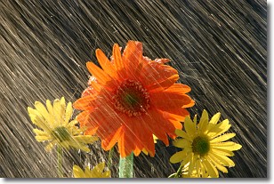
Weather Topic: What is Precipitation?
Home - Education - Precipitation - Precipitation
 Next Topic: Rain
Precipitation can refer to many different forms of water that
may fall from clouds. Precipitation occurs after a cloud has become saturated to
the point where its water particles are more dense than the air below the cloud.
In most cases, precipitation will reach the ground, but it is not uncommon for
precipitation to evaporate before it reaches the earth's surface.
When precipitation evaporates before it contacts the ground it is called Virga.
Graupel, hail, sleet, rain, drizzle, and snow are forms of precipitation, but fog
and mist are not considered precipitation because the water vapor which
constitutes them isn't dense enough to fall to the ground.
Next Topic: Rain
Current conditions powered by WeatherAPI.com


