Weather Alert in Utah
Avalanche Advisory issued February 20 at 5:52AM MST by NWS Salt Lake City UT
AREAS AFFECTED: Wasatch Mountains I-80 North; Wasatch Mountains South of I-80; Western Uinta Mountains; Wasatch Plateau/Book Cliffs; Central Mountains; Southern Mountains
DESCRIPTION: SABSLC * WHAT...The Utah Avalanche Center is warning of dangerous avalanche conditions across all Utah mountains this weekend. This week's heavy snowfall and strong winds overloaded preexisting weak layers, creating a HIGH avalanche danger across the entire state. With improving weather moving in for the weekend, avalanche accidents are likely in the backcountry. There have already been two tragic avalanche fatalities this week, as well as several close calls and numerous backcountry avalanches reported. * WHERE...The mountains of Utah and southeast Idaho. * WHEN...6 AM MST Friday, February 20th 2006 until Monday, February 23rd 2006 at 6 AM MST. * IMPACTS...Dangerous avalanche conditions exist in the backcountry and will persist through the weekend. Natural avalanches are possible, and people are likely to trigger avalanches on slopes steeper than 30 degrees. Dangerous and deadly avalanches can be triggered remotely (from a distance or from below). People leaving ski area boundaries are entering the backcountry where the same dangerous avalanche conditions exist.
INSTRUCTION: Backcountry travelers should consult www.utahavalanchecenter.org or call 1-888-999-4019 for more detailed information. This Bulletin does not apply to ski areas or highways where avalanche hazard reduction measures are performed.
Want more detail? Get the Complete 7 Day and Night Detailed Forecast!
Current U.S. National Radar--Current
The Current National Weather Radar is shown below with a UTC Time (subtract 5 hours from UTC to get Eastern Time).

National Weather Forecast--Current
The Current National Weather Forecast and National Weather Map are shown below.

National Weather Forecast for Tomorrow
Tomorrow National Weather Forecast and Tomorrow National Weather Map are show below.

North America Water Vapor (Moisture)
This map shows recent moisture content over North America. Bright and colored areas show high moisture (ie, clouds); brown indicates very little moisture present; black indicates no moisture.

Weather Topic: What is Evaporation?
Home - Education - Precipitation - Evaporation
 Next Topic: Fog
Evaporation is the process which returns water from the earth
back to the atmosphere, and is another crucial process in the water cycle.
Evaporation is the transformation of liquid into gas, and it happens because
molecules are excited by the application of energy and turn into vapor.
In order for water to evaporate it has to be on the surface of a body of water.
Next Topic: Fog
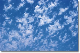
Weather Topic: What are Fractus Clouds?
Home - Education - Cloud Types - Fractus Clouds
 Next Topic: Freezing Rain
A fractus cloud (scud) is a fragmented, tattered cloud which has
likely been sheared off of another cloud. They are accessory clouds, meaning they
develop from parent clouds, and are named in a way which describes the original
cloud which contained them.
Fractus clouds which have originated from cumulus clouds are referred to as
cumulus fractus, while fractus clouds which have originated from stratus clouds
are referred to as stratus fractus. Under certain conditions a fractus cloud might
merge with another cloud, or develop into a cumulus cloud, but usually a
fractus cloud seen by itself will dissipate rapidly.
They are often observed on the leading and trailing edges of storm clouds,
and are a display of wind activity.
Next Topic: Freezing Rain
Current conditions powered by WeatherAPI.com


