Weather Alert in Kansas
Flood Watch issued August 27 at 2:30PM CDT until August 28 at 1:00PM CDT by NWS Wichita KS
AREAS AFFECTED: Ellsworth; Saline; Rice; McPherson; Marion; Chase; Reno; Harvey; Butler; Greenwood; Woodson; Allen; Sedgwick; Elk; Wilson; Neosho; Montgomery; Labette
DESCRIPTION: * WHAT...Flooding caused by excessive rainfall continues to be possible. * WHERE...Portions of Central, South Central, and Southeast Kansas, including the following counties, in Central Kansas, Chase, Ellsworth, Marion, McPherson, Rice and Saline. In South Central Kansas, Butler, Harvey, Reno and Sedgwick. In Southeast Kansas, Allen, Elk, Greenwood, Labette, Montgomery, Neosho, Wilson and Woodson. * WHEN...From 7 PM CDT this evening through Thursday afternoon. * IMPACTS...Excessive runoff may result in flooding of rivers, creeks, streams, and other low-lying and flood-prone locations. Low-water crossings may be flooded. * ADDITIONAL DETAILS... - A narrow zone of very heavy rainfall is expected to develop overnight into early Thursday morning along a Salina-to- Chanute line. Rainfall totals around 2 to 5 inches are currently being forecast with locally higher amounts possible. Though it has been relatively dry over the past 2 to 3 weeks, this amount of rainfall in a short amount of time could cause areas of localized flooding across the watch area.
INSTRUCTION: You should monitor later forecasts and be alert for possible Flood Warnings. Those living in areas prone to flooding should be prepared to take action should flooding develop. Be especially cautious at night when it is harder to recognize the dangers of flooding.
Want more detail? Get the Complete 7 Day and Night Detailed Forecast!
Current U.S. National Radar--Current
The Current National Weather Radar is shown below with a UTC Time (subtract 5 hours from UTC to get Eastern Time).

National Weather Forecast--Current
The Current National Weather Forecast and National Weather Map are shown below.

National Weather Forecast for Tomorrow
Tomorrow National Weather Forecast and Tomorrow National Weather Map are show below.

North America Water Vapor (Moisture)
This map shows recent moisture content over North America. Bright and colored areas show high moisture (ie, clouds); brown indicates very little moisture present; black indicates no moisture.

Weather Topic: What are Cumulus Clouds?
Home - Education - Cloud Types - Cumulus Clouds
 Next Topic: Drizzle
Cumulus clouds are fluffy and textured with rounded tops, and
may have flat bottoms. The border of a cumulus cloud
is clearly defined, and can have the appearance of cotton or cauliflower.
Cumulus clouds form at low altitudes (rarely above 2 km) but can grow very tall,
becoming cumulus congestus and possibly the even taller cumulonimbus clouds.
When cumulus clouds become taller, they have a greater chance of producing precipitation.
Next Topic: Drizzle
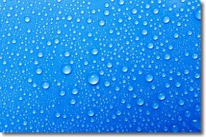
Weather Topic: What is Evaporation?
Home - Education - Precipitation - Evaporation
 Next Topic: Fog
Evaporation is the process which returns water from the earth
back to the atmosphere, and is another crucial process in the water cycle.
Evaporation is the transformation of liquid into gas, and it happens because
molecules are excited by the application of energy and turn into vapor.
In order for water to evaporate it has to be on the surface of a body of water.
Next Topic: Fog
Current conditions powered by WeatherAPI.com


