Weather Alert in Kansas
Red Flag Warning issued March 21 at 6:48PM MDT until March 22 at 3:00AM MDT by NWS Goodland KS
AREAS AFFECTED: Cheyenne; Rawlins; Decatur; Norton; Sherman; Thomas; Sheridan; Graham; Wallace; Logan; Gove; Greeley; Wichita; Dundy; Hitchcock; Red Willow
DESCRIPTION: * AFFECTED AREA...Fire Weather Zones 001 Cheyenne KS, 002 Rawlins, 003 Decatur, 004 Norton, 013 Sherman, 014 Thomas, 015 Sheridan, 016 Graham, 027 Wallace, 028 Logan, 029 Gove, 041 Greeley, 042 Wichita, 079 Dundy, 080 Hitchcock and 081 Red Willow. * TIMING...Until 3 AM MDT /4 AM CDT/ Sunday. * WINDS...Southerly to westerly at 5 to 15 mph through the remainder of the evening. Winds will abruptly shift to the north and increase to 25 to 35 mph with gusts to 45 mph during a cold frontal passage late tonight, between midnight and sunrise Sunday morning. * RELATIVE HUMIDITY...As low as 10 percent this evening. Relative humidity will gradually rise to 20 percent overnight and early Sunday morning. * IMPACTS...Unpredictable fire behavior. Any fires that develop may rapidly grow and spread out of control.
INSTRUCTION: Comply with burn bans and regulations. Avoid driving on dry grass or brush. Maintain vehicle brakes and tires and secure tow chains to avoid dragging. Never toss lit cigarettes onto the ground.
Want more detail? Get the Complete 7 Day and Night Detailed Forecast!
Current U.S. National Radar--Current
The Current National Weather Radar is shown below with a UTC Time (subtract 5 hours from UTC to get Eastern Time).

National Weather Forecast--Current
The Current National Weather Forecast and National Weather Map are shown below.

National Weather Forecast for Tomorrow
Tomorrow National Weather Forecast and Tomorrow National Weather Map are show below.

North America Water Vapor (Moisture)
This map shows recent moisture content over North America. Bright and colored areas show high moisture (ie, clouds); brown indicates very little moisture present; black indicates no moisture.

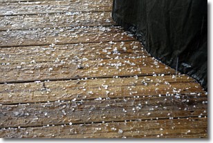
Weather Topic: What is Sleet?
Home - Education - Precipitation - Sleet
 Next Topic: Snow
Sleet is a form of precipitation in which small ice pellets are the primary
components. These ice pellets are smaller and more translucent than hailstones,
and harder than graupel. Sleet is caused by specific atmospheric conditions and
therefore typically doesn't last for extended periods of time.
The condition which leads to sleet formation requires a warmer body of air to be
wedged in between two sub-freezing bodies of air. When snow falls through a warmer
layer of air it melts, and as it falls through the next sub-freezing body of air
it freezes again, forming ice pellets known as sleet. In some cases, water
droplets don't have time to freeze before reaching the surface and the result is
freezing rain.
Next Topic: Snow
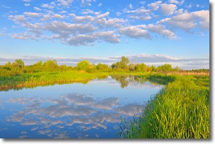
Weather Topic: What are Stratocumulus Clouds?
Home - Education - Cloud Types - Stratocumulus Clouds
 Next Topic: Stratus Clouds
Stratocumulus clouds are similar to altocumulus clouds in their
fluffy appearance, but have a slightly darker shade due to their additional mass.
A good way to distinguish the two cloud types is to hold your hand out and measure
the size of an individual cloud; if it is the size of your thumb it is generally
an altocumulus cloud, if it is the size of your hand it is generally a
stratocumulus cloud.
It is uncommon for stratocumulus clouds to produce precipitation, but if they do
it is usually a light rain or snow.
Next Topic: Stratus Clouds
Current conditions powered by WeatherAPI.com


