Weather Alert in Georgia
Special Weather Statement issued March 7 at 3:56AM EST by NWS Charleston SC
AREAS AFFECTED: Jenkins; Screven; Candler; Bulloch; Tattnall; Evans; Allendale; Hampton; Inland Colleton; Dorchester; Inland Berkeley; Inland Jasper; Beaufort; Coastal Colleton; Charleston; Coastal Jasper; Tidal Berkeley
DESCRIPTION: Areas of fog will continue to develop across much of the South Carolina Lowcountry and Southeast Georgia through sunrise. The fog could become locally dense at times with visibility dropping to 1/4 mile or less. The nature of the fog is such that visibilities will vary greatly over short distances with the risk for locally dense fog being the greatest near bodies of water and other low- lying areas such as marshes, swamps and large ditches. Motorists should remain alert for these conditions this morning. It is possible more widespread dense fog could develop prior to daybreak and a Dense Fog Advisory may be issued.
INSTRUCTION: If driving, slow down and leave extra distance ahead of you in case a sudden stop is needed.
Want more detail? Get the Complete 7 Day and Night Detailed Forecast!
Current U.S. National Radar--Current
The Current National Weather Radar is shown below with a UTC Time (subtract 5 hours from UTC to get Eastern Time).

National Weather Forecast--Current
The Current National Weather Forecast and National Weather Map are shown below.

National Weather Forecast for Tomorrow
Tomorrow National Weather Forecast and Tomorrow National Weather Map are show below.

North America Water Vapor (Moisture)
This map shows recent moisture content over North America. Bright and colored areas show high moisture (ie, clouds); brown indicates very little moisture present; black indicates no moisture.

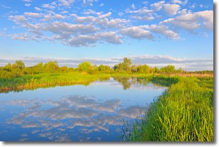
Weather Topic: What are Stratocumulus Clouds?
Home - Education - Cloud Types - Stratocumulus Clouds
 Next Topic: Stratus Clouds
Stratocumulus clouds are similar to altocumulus clouds in their
fluffy appearance, but have a slightly darker shade due to their additional mass.
A good way to distinguish the two cloud types is to hold your hand out and measure
the size of an individual cloud; if it is the size of your thumb it is generally
an altocumulus cloud, if it is the size of your hand it is generally a
stratocumulus cloud.
It is uncommon for stratocumulus clouds to produce precipitation, but if they do
it is usually a light rain or snow.
Next Topic: Stratus Clouds
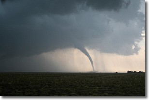
Weather Topic: What are Wall Clouds?
Home - Education - Cloud Types - Wall Clouds
 Next Topic: Altocumulus Clouds
A wall cloud forms underneath the base of a cumulonimbus cloud,
and can be a hotbed for deadly tornadoes.
Wall clouds are formed by air flowing into the cumulonimbus clouds, which can
result in the wall cloud descending from the base of the cumulonimbus cloud, or
rising fractus clouds which join to the base of the storm cloud as the wall cloud
takes shape.
Wall clouds can be very large, and in the Northern Hemisphere they generally
form at the southern edge of cumulonimbus clouds.
Next Topic: Altocumulus Clouds
Current conditions powered by WeatherAPI.com


