Weather Alert in Washington
Red Flag Warning issued August 25 at 6:32AM PDT until August 26 at 9:00PM PDT by NWS Spokane WA
AREAS AFFECTED: East Washington Central Cascades; East Portion of North Cascades National Park / Lake Chelan National Recreation Area; East Washington North Cascades; Methow Valley
DESCRIPTION: ...HOT, DRY, AND UNSTABLE CONDITIONS FOR MONDAY AND TUESDAY ALONG WITH THE POTENTIAL FOR ISOLATED THUNDERSTORMS WITH GUSTY OUTFLOW WINDS... .Hot, dry, and unstable conditions are forecast along the East Slopes of the Central and Northern Cascades as well as the Methow Valley Monday and Tuesday. In addition, we are monitoring the potential for isolated thunderstorms on Monday and Tuesday afternoons that could result in new fire starts along with gusty outflow winds. * Affected Area: East Washington Central Cascades (Zone 696), East Portion of North Cascades National Park/Lake Chelan National Recreation Area (Zone 697), East Washington North Cascades (Zone 698) and Methow Valley (Zone 704). * Winds: Southeast around 5 mph in the afternoon shifting to northwest in the evening, except gusty outflow winds near thunderstorms. * Timing: Afternoon and evening for both Monday and Tuesday. * Relative Humidities: Below 4000 feet: 13 to 20 percent. Above 4000 feet: 20 to 30 percent. * Temperatures: Below 4000 feet: 90 to 102 degrees. Above 4000 feet: 75 to 90 degrees. * Lightning: A 5-10 percent chance of dry thunderstorms late Monday afternoon into the evening. A 20-25 percent chance of thunderstorms Tuesday afternoon and evening mainly over the higher terrain. * Impacts: Hot, dry, unstable conditions may lead to rapid fire growth on any new or existing fires. Isolated thunderstorms will bring the potential for new fire starts, as well as gusty outflow winds.
INSTRUCTION: A Red Flag Warning means that critical fire weather conditions are either occurring now....or will shortly.
Want more detail? Get the Complete 7 Day and Night Detailed Forecast!
Current U.S. National Radar--Current
The Current National Weather Radar is shown below with a UTC Time (subtract 5 hours from UTC to get Eastern Time).

National Weather Forecast--Current
The Current National Weather Forecast and National Weather Map are shown below.

National Weather Forecast for Tomorrow
Tomorrow National Weather Forecast and Tomorrow National Weather Map are show below.

North America Water Vapor (Moisture)
This map shows recent moisture content over North America. Bright and colored areas show high moisture (ie, clouds); brown indicates very little moisture present; black indicates no moisture.

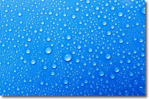
Weather Topic: What is Evaporation?
Home - Education - Precipitation - Evaporation
 Next Topic: Fog
Evaporation is the process which returns water from the earth
back to the atmosphere, and is another crucial process in the water cycle.
Evaporation is the transformation of liquid into gas, and it happens because
molecules are excited by the application of energy and turn into vapor.
In order for water to evaporate it has to be on the surface of a body of water.
Next Topic: Fog
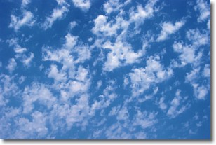
Weather Topic: What are Fractus Clouds?
Home - Education - Cloud Types - Fractus Clouds
 Next Topic: Freezing Rain
A fractus cloud (scud) is a fragmented, tattered cloud which has
likely been sheared off of another cloud. They are accessory clouds, meaning they
develop from parent clouds, and are named in a way which describes the original
cloud which contained them.
Fractus clouds which have originated from cumulus clouds are referred to as
cumulus fractus, while fractus clouds which have originated from stratus clouds
are referred to as stratus fractus. Under certain conditions a fractus cloud might
merge with another cloud, or develop into a cumulus cloud, but usually a
fractus cloud seen by itself will dissipate rapidly.
They are often observed on the leading and trailing edges of storm clouds,
and are a display of wind activity.
Next Topic: Freezing Rain
Current conditions powered by WeatherAPI.com


